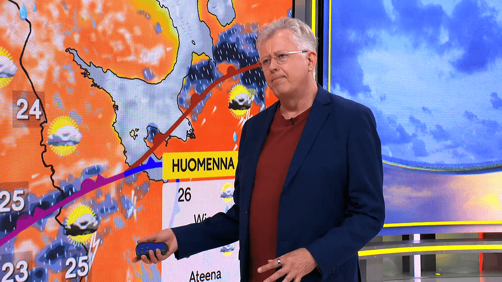
Tropical Cyclone Alert : Tropical Storm Nando (RAGASA)
“NANDO” INTENSIFIES INTO A TROPICAL STORM.
Location of eye/center : The center of Tropical Storm NANDO was estimated based on all available data at 1,175 km East of Central Luzon (15.9, 133.0).
Strength : Maximum winds of 65 kph near the centerand gustiness of up to 80 kph.
Forecast movement : Forecast to move West Northwestward at Slowly kph
Forecast position :
Sep 19, 2025 08:00 AM - 1,020 km East of Central Luzon
Sep 19, 2025 08:00 PM - 925 km East of Central Luzon
Sep 20, 2025 08:00 AM - 895 km East of Central Luzon
Sep 20, 2025 08:00 PM - 865 km East of Northern Luzon
Sep 21, 2025 08:00 AM - 755 km East of Aparri, Cagayan
Sep 21, 2025 08:00 PM - 600 km East of Aparri, Cagayan
Sep 22, 2025 08:00 PM - 170 km East of Calayan, Cagayan
Sep 23, 2025 08:00 PM - 425 km West of Basco, Batanes (OUTSIDE PAR)
HAZARDS AFFECTING LAND AREAS
Heavy Rainfall Outlook
NANDO is less likely to directly affect the weather in the next 48 hours. Onset of heavy rains due to the Southwest Monsoon and NANDO is possible by Sunday (21 September) or Monday (22 September).
Severe Winds
NANDO may potentially enhance the Southwest Monsoon as it approaches the landmass. Wind Signal No. 1 will be hoisted over Northern Luzon as early as Saturday (20 September), and the highest Wind Signal that may be hoisted throughout its passage is Wind Signal No. 5 considering that this tropical cyclone has a possibility to reach super typhoon category.
The Southwest Monsoon will bring strong to gale-force gusts over the following areas (especially in coastal and upland areas exposed to winds):
Today: Babuyan Islands, Ilocos Norte, Ilocos Sur, La Union, Pangasinan, and Zambales
Tomorrow (19 September): Ilocos Region, Zambales, Bataan, Bicol Region, and Eastern Visayas
Saturday (20 September): Bicol Region, Eastern Visayas, and Caraga
HAZARDS AFFECTING COASTAL WATERS
24-Hour Sea Condition Outlook
In the next 24 hours, NANDO is unlikely to affect the sea condition. Moderate to rough seas is likely over most of the coastal waters of Luzon beginning by Sunday. Increasing significant wave heights reaching up to 14.0 m is possible as NANDO approaches Extreme Northern Luzon.
Coastal Inundation
Storm surge warning may be raised over the coastal waters of Northern Luzon as early as Saturday (20 September).
TRACK AND INTENSITY OUTLOOK
NANDO is forecast to move west northwestward to westward over the Philippine Sea in the next 24 hours. It may move in a loop pattern before turning generally northwestward to west northwestward from tomorrow evening (19 September) until Sunday (21 September) evening. Afterwards, it is forecast to move westward while approaching Extreme Northern Luzon. On the forecast track, the center of NANDO may pass close or may make landfall over Babuyan Islands from Monday (22 September) afternoon until Tuesday (23 September) morning. It may exit the Philippine Area of Responsibility by Tuesday afternoon or evening.
NANDO will continue to intensify while over the Philippine Sea and may reach typhoon category by Saturday. Further intensification into super typhoon category while traversing the Extreme Northern Luzon is not ruled out.
Varoitus voimassa to klo 18:07 - pe klo 7:07